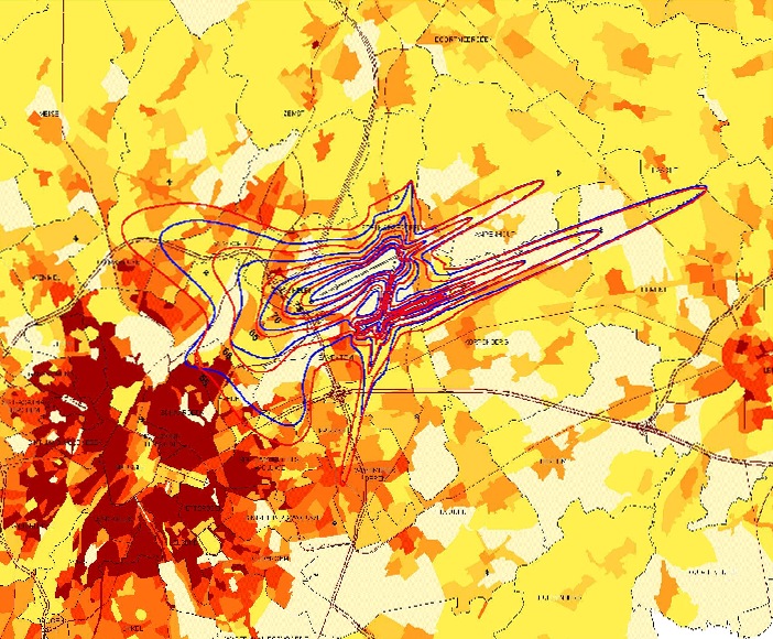
Day
for Brussels Airport (by BIAC).
It is a composed version: year 1999 (red), 2000 (blue). The background
is a population density map: Brussels-city can be recognised at the South-West-side
of the airport.
Scale: the map represents about 32 x 25 km of earth surface.
The contours of 2000 are the newest available.
